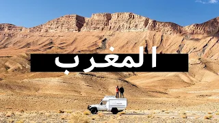
MOROCCO TRAVEL DOCUMENTARY | The Grand Moroccan Roadtrip
May 08, 2024Morocco – From wind-sculpted sand dunes to snow-capped mountains, sophisticated architecture and vibrant souks, Morocco is a pendulum swinging between bustling activity and desert stillness. Whether on or off the road, on strenuous summit hikes or on camelback, adventures and mishaps await the daring
travel
er. 8 weeks, 10,000 kilometers and a large number of sounds, images and smells: this is the Great Roadtrip through Morocco. Our journey through Morocco began by disembarking from the ferry in the large port of Tangier Med. Quickly leaving the port behind, we traversed the rolling north of the country until we reached Chefchaouen. Chaouen, as the locals call it, is well known for the blue color of its buildings.
There are several theories as to why the city was initially painted blue, ranging from the color's relaxing effect to its depiction of sky and sky. Others simply say it was done to attract visitors, a strategy that definitely worked. Most of the medina can only be explored on foot, as the steep alleys are too narrow for vehicles. Needless to say, this helps greatly in creating a calm atmosphere. After having enjoyed this Blue Pearl of Morocco, we headed towards the nearby Talassemtane National Park. To our surprise, we soon found ourselves facing huge rock walls. Its reddish color provided a nice contrast with the green of the vegetation.

More Interesting Facts About,
morocco travel documentary the grand moroccan roadtrip...
Originally, the park was created to protect the last fir trees in Morocco. Today, it is best known for its hiking trails. Several of them run along emerald mountain streams. Unfortunately, its natural beauty is often tarnished by human pollution. Our destination was none other than God's Bridge, a large rock arch that spanned the deep gorge. Surrounded by the smell of countless riverside restaurants, we decided to try some typical Moroccan dishes for lunch. While the river had already been stunning before, the views got even better as we continued towards the coast. Shortly after we arrived at the shore of the Mediterranean which we would hug for the next few days.

Of course, we stopped regularly to take in the scenery, marveling at the winding coastal road, the many fishing villages and the interesting shapes of the coastline. Like so many times in the past, we found one of our favorite spots by following a small off-road trail. Framed by snow-capped peaks and towering over a small village, this ancient fort used to protect nearby settlements. 5 km later the road ends and suddenly we look towards Spain. Now, the Spanish peninsula is, of course, more than 100 km away, but this small peninsula officially belongs to the European nation. Originally an island, a massive storm blew large amounts of sand into the former strait, creating the shortest land border between two countries in the world.

Moving steadily east towards the Algerian border, we passed through some badly eroded wasteland before ending on a ruined coastal road. Finally we reached Cape Three Forks, where an old lighthouse marks the northern end. All day long, dark clouds had already been a sign, but shortly after leaving the cape, rain finally broke through. Luckily, the next morning the sun returned. Strolling along a large sandy beach, we enjoyed the thunderous sound of the waves. A few steps away, the mouth of the Moulouya River offers an excellent opportunity to observe local fauna. Among the numerous birds, the long-legged flamingos were the most striking.
After exploring the entire Mediterranean coast of Morocco, it was time to enter the desert. With each kilometer south, the big clouds retreated further and we were soon marveling at the first small sand dunes along the road. To fully immerse ourselves in the isolation of the desert, we left the road behind and headed into the wilds of eastern Morocco. A few minutes into the walk, we passed the abandoned buildings of an old train station, a first indication of the unforgiving landscapes we were going to find. Meanwhile, the sun was sinking into the horizon, turning the landscape a wonderful red color.
Minutes before sunset, we pulled up to the trailside to set up camp, ready for our first night in the desert. After a cold night with temperatures down to -4° Celsius, the next day brought us cloudy skies and sandy trails. However, the landscape was fascinating as it kept changing in rapid succession. That change is also evident on a larger scale, as the field is in a constant state of flux. Wind and weather relentlessly shape the land, creating elaborate works of natural art in the process. The undulating patterns of the sand dunes are eternal and ephemeral, a truly intriguing juxtaposition.
Continuing through this remote area of the country, we didn't see another car for two days. Instead, we marvel at landscapes rarely visited and mostly untouched by humans. Plus, the off-road trail was a lot of fun to ride, making it one of our favorite parts of the entire trip. More than 100 kilometers of desert solitude,
travel
ed calmly, provided us with endless natural wonders. One moment we were surrounded by low bushes eking out a living on sandy soil, while the next we were driving through the seeming desolation of a stone desert. Infusing a sense of natural simplicity, it is exactly these types of landscapes that we crave when we embark on a road trip.The closer we got to the southeast, the closer we got to a range of mountains, many of which were capped with a thin layer of snow. Back on a paved road, the kilometers began to fly by, helping us move at a good pace towards the easternmost settlement in Morocco. Surrounded by Algeria on three sides, the small settlement of Iche is literally an oasis in the desert. Local inhabitants grow date palms and practice agriculture in small irrigated fields. Apart from a single paved road in and out of town, all other roads in the surrounding area are gravel, many of which are very undulating.
Normally, this would be the perfect place to lift the drone into the air and get a good aerial shot of the vehicle moving across the landscape. But since Morocco completely bans the importation of drones and all my requests for permission were duly ignored, we now have to use our feet to get a similar bird's-eye perspective. As we continued south, we traversed an arid landscape characterized by rugged peaks, dry riverbeds, and peculiar flora. Scientifically known as anabasis, these dwarf subshrubs are also called desert cauliflower, although in our opinion, desert broccoli would be much more appropriate. These strange plants, which form dense hemispherical cushions with numerous small, leathery leaves, survive both hyperdry periods and the difficulties of cold winters.
As we approached the Figuig oasis, we first had to pass one of the usual police checkpoints. Like Iche, Figuig is surrounded by Algeria on three sides. Composed of seven villages, the oasis is known for its large palm grove comprising almost 200,000 date palms. For centuries, a sophisticated irrigation system has allowed the local population to survive in this otherwise inhospitable environment. The main crop of the oasis is, of course, the date, which is exported by the millions. These deliciously sweet fruits are rich in healthy minerals while being nutritious, earning them the nickname Desert Bread. Back inland, we headed straight into a storm with swirls of dust whipping across the desert.
And then something almost incredible happened. It started to snow. Large white flakes fell from the sky. With every minute we stayed outside to watch this incredible spectacle, the snowfall intensified. Soon, a thin blanket of snow began to cover the red rocks, completely transforming the landscape. The next day started out just as impressive, although with sunshine instead of snow. Driving through this landscape, the existential importance of water becomes evident. As a literal source of life, its presence or absence determines where humans and animals can survive and thrive. While most of the countryside appears completely arid, the river beds, although apparently dry, are rich in vegetation.
Already amazed by the scenery, we were even more amazed when we entered a particularly imposing gorge. With the steep walls rising above, this was one of the most spectacular roads in Morocco. After each curve a new panorama opened up, each one more impressive than the last. But even after leaving the gorge behind, the views didn't stop, as the next mountain plateau was equally impressive. A common means of transportation in these remote areas are donkeys and mules, which are often seen carrying heavy loads. That said, if vehicles are used, they are equally loaded. Leaving the mountains behind for the moment, we headed southeast, returning to the desert.
The entire landscape around us is plagued by what appear to be giant molehills. However, these mounds of earth are not exactly of natural origin. They are the superficial remains of an elaborate irrigation system. In fact, each of these mounds is the result of sinking a well to create an underground channel that would supply nearby oases with a constant flow of water. Built about 300 years ago, the so-called Khettara were always built on slightly sloping terrain. Instead of spending many resources laboriously drawing water from a well, the extracted groundwater took the path of least resistance and flowed directly to the oasis.
Soon we began to approach a horseshoe-shaped mountain, which was once a fortress. A gravel path leads to the top of the hill, from where a wonderful view opens up. This is a perfect place to take in the vastness of the surrounding desert from an elevated position. As the day drew to a close, we continued driving east until we approached the large sand dunes of Erg Chebbi. The next morning, we woke up in the dark to watch the sunrise over the dunes. For that, we swapped our 4x4 for what our guide jokingly called an 8x8. Perfectly adapted to this desert environment, Arabian camels have very wide legs that allow them to walk easily on the sand.
Packed into countless layers of clothing due to the frigid temperatures, we rocked back and forth as we were constantly carried uphill. About an hour later, we gave the camels a well-deserved rest and continued on foot. And our timing couldn't have been better. Within moments, the sun rose over the crest of the dune, casting a warm light on us and illuminating the landscape. Half an hour later we returned to our camels, which in the meantime had been busy chewing the cud. Although camels are not true ruminants, they have also developed a chambered stomach that allows them to ferment their plant foods to extract maximum nutrients.
Once everyone was ready, our camels rose with all the grace they could muster. Needless to say, the dunes had not stopped watching us. Stretching for more than 20 km from north to south, Erg Chebbi offers many opportunities for exploration. Countless sandy trails surround this sea of dunes, while experienced off-roaders can even attempt to cross it directly. In the afternoon we look for a suitable place to sleep. Satisfied with our find, we began the climb. Our camp was nestled between the dunes, completely submerging us in the sandy ocean of the Erg. Spellbound by the landscape, one dune in particular caught my eye.
Its curved crest was too tempting to resist, so I soon found myself drawn towards it. At first the sand was quite compact, which allowed me to make good progress. However, all that was about to change. The higher I went, the more the sand began to give way. The thing about these sand dunes is that they are extremely beautiful to look at, especially from afar, but climbing to their top is absolutely arduous to say the least, but now there is only willpower between me and the top. Finally, I managed to reach the top. summit where I was rewarded with an amazing view.
The Erg Chebbi dunes, with a height of up to 150 m, are simply majestic. Particularly interesting was how the size of the dunes alternates between quite small and absolutely massive. Even more intriguing, however, was observing the growth of the shadows. The perfect complement to this contrasting play of light and dark were the ever-changing wavy patterns of the sand. Soon, sunset was near and the dunes were once again bathed in soft light. The next morning we completed our circumnavigation of Erg Chebbi, passing many tourist camps in the process. Shortly after we embarkedon one of the best-known desert trails in Morocco.
Especially fun to drive were the large salt flats. Its smooth surface was the pleasant counterpart to an otherwise bumpy road. In fact, most of the time, the track was rough, especially when passing through segments of stone desert. Deviating from the main trail, we headed to a city lost in the middle of the desert. Located atop a large rock, the settlement is said to have been a refuge for independence fighters during the French occupation. Other than that, not much is known about the ancient town, which of course made it even more exciting to explore. Regardless of its history, the landscape surrounding the settlement was immensely beautiful.
Continuing through the immensity of the stone desert, we fully embrace the remote solitude of the landscape. Although we barely met another human being, Arabian camels were a common sight. Also known as dromedaries or one-humped camels, these hardy beasts are known for their extreme tenacity and perseverance. Without domesticating them, man would have been unable to conquer the desert. Various adaptations allow these animals to thrive in an environment where others succumb to thirst and hunger. Aside from their bushy eyebrows with extra-long eyelashes to ward off sand and the ability to not drink water for two weeks, it's the structure of their mouths that really sets them apart.
Their hard, flexible lips move independently of each other, allowing them to feed on thorns and bushes. Their teeth grind food against their hard palate, while the inside of their mouth is filled with cone-shaped structures called papillae. These move all the pointed spines vertically towards their throats, without pricking them in the process. While young calves will occasionally nibble on some grass, they generally prefer their mother's milk. After a pregnancy that lasts 15 months, female camels give birth to a single calf. Within hours, the calf is able to walk and remains close to its mother for the next 1 or 2 years.
Returning to the main path, we pass through a track of pleasant sand, with a lot of bushy vegetation. Shortly afterward the great Maider Lake appeared before us. This huge salt flat can only be crossed in dry conditions. Luckily, not a single cloud was visible. Up until this point, the trail had always provided us with some visual interest. However, the next part was characterized by total monotony. As if it had cast a spell on us, the profound nothingness of the landscape cleansed our minds of all thought. It was only the incessant rattling of the car that finally broke our hypnotic trance.
At some point, the landscape began to change again, with hills and trees celebrating their return. Since the trail runs just a few kilometers from the Algerian border, travelers must pass several military checkpoints along the way. After a long day of driving, we needed to conquer one more mountain pass before we could set up camp. With every meter we climbed, the view began to improve as a large valley opened up in front of us. Our campsite gave us an amazing view, although at the cost of a very windy night. After traversing another rocky stretch the next morning, we soon found ourselves in a landscape that reminded us a little of southern Namibia.
But we didn't stay long and kept going until we reached Erg Lihoudi. This dune course is not as spectacular as other Ergs, but it is an ideal playground for anyone getting their fill of sand for the first time. But even without an off-road vehicle, a visit to the area is time well spent. On a windy day, travelers can witness nature's relentless quest to alter the landscape. In a display of natural craftsmanship, the wind effortlessly picks up sand particles and carries them to distant places. Looking for a path that would take us even further into the desert, we left Erg Lehoudi behind and followed little-traveled paths towards Erg Zaher.
The largest dune in Erg Zaher, rising high above all the others, is known as the Lion Dune. Its summit is an ideal place to have a perspective of the extraordinary surroundings. Despite the seemingly inhospitable desolation of the landscape, life always finds a way. Incredibly hardy grasses take root in even the highest dunes. Although in this case, the years of drought have definitely left their mark. Much more vivid are the restless dusky beetles that can often be found wandering around. As generalist omnivores, they forage for anything from decaying plant material to small insects. However, from time to time, they need a gentle guide to avoid being hit by a car.
Once we took care of the beetle, we tackled our steepest dune to date. All day long our path took us through a wonderfully remote desert, in which sand was the omnipresent element. Offering natural variety and plenty of driving fun, this track easily ranks among our all-time favorite off-road adventures. While a 4x4 is probably the fastest way to explore the landscape, those who prefer to travel more slowly can also trek with camels. By doing so, you will gain a deeper understanding of the difficulties that previous generations faced living in an environment as unforgiving as the desert. However, if you travel by car, make sure it has enough power, as the stretches of bull dust that appear periodically require all the strength you can muster.
The hidden ruts are surprisingly deep and this is definitely not a place you want to get stuck in. On the plus side, driving through this dusty landscape looks absolutely epic. We soon started heading towards Erg Chegaga, the largest dune field in Morocco. Compared to Erg Chebbi, Erg Chegaga is much more pristine as it is far from everything. This applies especially to the southern end, where only the occasional off-roader or guided group finds the way. Therefore, the vast sea of sand is a perfect escape from the complexities of modern life. Time seems to have stopped in this otherworldly landscape.
Looking for a secluded place to camp, we headed straight for the dunes. Of all our camps in Morocco, this was by far the quietest. After collecting some dead wood, we lit a fire which helped create a calmer atmosphere. Enjoying each other's presence in this desert solitude, Anna felt overwhelmed with emotions and, as a result, she even shed a few happy tears. The next day, skirting the southern flank of the Erg, we continued driving over countless dunes. In the end the sand gave way to a huge salt flat that we crossed in a fairly straight line. Embarking on a small side trail, we soon came across a herd of donkeys.
This particular group was made up of more than 15 individuals, all of which were peacefully feeding on the side of the road. In the wild, donkeys spend a considerable amount of time searching for grasses and bushes each day. Except for camels, they depend on water, especially during winter when most of their food is dry. Seeing a well nearby, we got to work providing these kind animals with a refreshing drink. If you ask us, the donkeys were pretty happy with that decision. Not far away, we discovered a series of impressive rock formations along the trail. Over millennia, the soil slowly eroded, leaving behind only the hardest rock.
In this area you can find several interesting shapes, such as a slender needle. Early the next morning, the scenery was especially beautiful. At first, the landscape was tinted a red hue, but as the sun rose, the color began to change to orange and finally gold. Serenaded by a flock of trumpeter finches, this marked the wonderful end to our week-long desert adventure. Over the last seven days we have covered over 500km on remote off-road trails. Now that we are about to hit paved roads again, we of course have to readjust the tire pressure. But there is one more thing we need to check and that is the air filter, as it may have accumulated quite a bit of dust over the last few days.
And indeed it was! Having explored much of eastern Morocco, it was time to head inland. After a short stretch of road, marveling at a massive mountain massif, we headed onto a gravel path that passes just below a rock wall. Taking this mountain shortcut, which like all good shortcuts, took much longer than the main road, we finally reached our destination, the rock carvings of Aït Ouazik. The engravings, which date back around 8,000 years, offer a detailed picture of the local fauna of the time. Considered one of the first artistic expressions of modern man, petroglyphs were often used to transmit knowledge from one generation to another.
Although this particular site was quite small, it was interesting to glimpse the long human history of Morocco. A little further east, where the desert meets the mountains, many nature trails offer stunning views. But for us the time had come to climb an even more imposing rock massif. Following small country roads, we slowly ascended the Jbel Saghro flyovers. This mountain range is of volcanic origin, which is easy to imagine when you see all the dark rock. Completely blocked from the Atlantic Ocean by higher peaks to the west, the area is extremely dry. However, the desolation of this harsh landscape has an intriguing appeal.
Even more interesting, however, were the rock formations similar to those in Arizona. Camping beneath one of those monuments, we enjoyed the afternoon sun on the landscape. Suddenly, the silence of the landscape was interrupted by a chorus of bleating. At the top of the rocks, a shepherdess kept a careful eye on her flock. In rural Morocco, livestock farming is the backbone of the economy. No matter how remote the place is, there is always a shepherd with his animals near him. Continuing on, our trail passed through a landscape of red rocks and green grasses. In the distance, we could even make out the snow-capped peaks of the High Atlas.
Much smaller but equally fascinating were the Barbary ground squirrels we saw among the rocks. A short drive away is the town of Tinghir, in the foothills of the High Atlas. The city is known as the gateway to a massive limestone river canyon. Certainly an impressive sight at its narrowest point, we felt a little overwhelmed seeing so many other people. Leaving behind the most popular stretch of the gorge, we drove steadily uphill, enjoying the canyon scenery alone. To stretch our legs after days of driving, we decided to go for a little walk. Even though it was very cold, braving the cold conditions quickly paid off.
Well hidden in a mountain valley, this formidable rock arch was quite a sight. Looking around, it was obvious that we had gained altitude as a layer of snow covered the surrounding peaks. Enjoying the benefits of a newly paved road, we moved forward at a good pace, until the asphalt suddenly stopped. The path he followed is the last vestige of what used to be a very dangerous path to the Dadès Gorges. In our case, the adventure was amplified by the sudden snowfall. Eons ago, this entire area was at the bottom of the sea, but due to the shifting of tectonic plates, the Atlas Mountains rose.
Eroding sedimentary rock over thousands of years, the Dadès River created an impressive canyon. In some places, the walls of the gorge reach 500 m in height. A third gorge in the area is known as Valley of the Roses. Compared to the other two, it is much less visited and at the same time offers wonderful views. Traditional villages line the riverbank in a truly idyllic setting. In the fields, women can be seen cutting reeds to make baskets and other crafts. Taking another of our famous shortcuts, we ended up on a long, slow gravel track. Well, let's be completely frank.
This is not exactly the route I anticipated. This is an extremely steep mountain pass with very tight curves, of course gravel, large stones and quite steep drops on this side, but yes, we are taking it easy now and I think in the distance you can see a paved road. On the plus side, the scenery was absolutely stunning. The same also happened with the towns further down the valley. Many of the buildings were constructed using the traditional rammed earth construction technique. To do this, natural materials such as sand, clay and straw are compacted in a formwork. Visually, the resulting buildings fit perfectly into the landscape.
The next day, a massive rain front arrived that would bring precipitation to most of the country. The rains were so intense that in a short time the previously dry river beds began to swell until they became raging torrents. It wasn't long until even the road was submerged, causing several road closures. With floods soheavy on day 1 and 5 more days of rain in the forecast, we decided to push south as hard as we could. Our goal was to leave central Morocco behind and head directly towards Western Sahara. Politically, this region is a disputed area, with both Morocco and the so-called Sahrawi Arab Democratic Republic claiming the land.
While in the past bloody battles were fought on this strip of virtually empty desert, today tourists can visit the coast unhindered. The only sign of this unresolved conflict is the numerous military checkpoints. After passing through the regional capital, Laâyoune, where 40% of Western Sahara's population lives, we embarked on an 800 km journey towards the Mauritanian border. Outside the city, we were quickly embraced by a desolate, sand-swept nothingness. Despite being larger than the United Kingdom, Western Sahara is sparsely populated. Experiencing firsthand the utter hostility of the landscape was no surprise to us. Naturally, whenever the opportunity presented itself, we stopped to take in the view.
Along much of the coast, the Atlantic Ocean hits the land, creating a stunning cliff in the process. However, in general, a road trip through Western Sahara is quite monotonous, since the scenery does not change for hundreds of kilometers. Despite this, the city of Dakhla is popular among tourists, as the nearby lagoon offers perfect conditions for lovers of wind sports. With about 300 kilometers left to travel, we continue south along this Empty Highway until we reach the border with Mauritania. We have achieved it. We have reached the southern tip of Morocco, because from here, from this point, we can see the border with Mauritius.
And the road continues towards West and Central Africa but this is an adventure that we will leave for another day. For us, this point means turning north and exploring the remaining wonders of Morocco. Driving in the opposite direction, the scenery remained the same, but we continued with a sense of accomplishment, having reached the other end of the country. Hidden behind a small sand dune, we set up camp after another long day of travel. Always following the coastline towards the north, we finally reached the Assalama wreck. The ferry connected Morocco with the Canary Islands until she ran aground in 2008.
Despite pleas from Morocco, the Spanish company that owns the ship has so far failed to clean up its mess. Not far away, Khenifiss National Park is home to the country's largest coastal lagoon. The site is known as a winter habitat for migratory species that flock here by the thousands. A different type of herd, overland campers, equally appreciate this area. And frankly, we couldn't imagine a better place to relax. Setting up camp at the top of the cliff, we observe the perpetual movements of the tide. In fact, we liked it here so much that we stayed 2 whole days.
Saying goodbye to Western Sahara, we continue along the coast, until we reach Ksar Tafnidilt. The ancient castle stands on top of a hill and dominates the surrounding landscape. Fully protected by battlements, this fortress offered a lot of space during an armed conflict. Although many of its walls have collapsed, walking through the ruins was still impressive. The Ksar is also the starting point of an exciting off-road route, for which we collaborated with Ina and Jeroen from the Netherlands. It wasn't long until we climbed a steep hill section. At times the track surface was covered in decent sized rocks, requiring very careful driving.
Approximately 30 km into the trip we arrive at the mouth of the Draa, where the longest river in Morocco empties into the Atlantic Ocean. From there, the trail followed the coast, passing many military huts and fishing settlements. At several points we stopped on the cliffs and looked out over the ocean. Most of the time, the trail was rocky, but occasionally, sandy sections made us jump even more. The rains of the previous week also left their mark here, to the delight of some camels. As we moved forward, sand dunes began to cover what was once the trail. And then, for a moment, Lady Fortune was distracted.
Despite the low pressure in our tires, a sharp rock managed to tear the sidewall of our rear tire, leaving a nasty gash. This left us no choice but to change the tire. While we were still busy coming up with a proper strategy to lift the car on sandy ground, three locals appeared and took a look at our situation. Knowing immediately what needed to be done, they expertly directed us before dropping to the ground without a second thought. Eventually the tire came loose and they put the spare in its place. Just as quickly as they had appeared, these good Samaritans disappeared again, leaving us extremely grateful for their selfless willingness to help.
Since we had missed the low tide window on the next stretch of beach, we decided to look for a good place to camp among the sand dunes. Today, we are reminded again of a very important lesson: that when you travel in nature not everything always goes according to plan and that is exactly what happened to us today when the sidewall of our tire was destroyed by a very sharp stone. But as is often the case in these situations, they may leave you a little scared, angry or fearful, but in retrospect, they are absolutely the best stories to tell.
We spent the rest of the day in good company and just relaxing in this wonderful place. Refreshed and in good spirits, we set off the next morning. Following a small path to Plage Blanche, we soon reached the large open beach. With the Atlantic to the left and sand dunes to the right, we glide gently over the long beach. Apart from the occasional fisherman, the 40 km long White Beach was completely deserted. However, that same isolation can be dangerous. It's important to time the tides as you don't want to get stuck with incoming water. While we barely saw another human being, we encountered huge flocks of seagulls.
The only way to leave the beach at its northern end is to climb a steep hill. But, with all-wheel drive and low gear engaged, we climbed the rocky slope with ease. After saying goodbye to our traveling companions at the ruins of Fort Bou Jerif, we washed all the sea salt off the car. Continuing north, the landscape began to change before our eyes. The vegetation was no longer so scarce, since many different species can be found in this habitat. The most prominent plant in the region is the argan tree, which grows almost exclusively in Morocco. The fruits of the tree are used to produce the highly sought after argan oil, known for its numerous health and beauty benefits.
Moving inland, we soon approach the Anti-Atlas, the southernmost part of the Atlas Mountains. One of the most famous settlements in the area is Amtoudi. Aside from its picturesque location, the village is best known for its two Agadirs, expertly built as extensions of the rock face. Both date back more than 500 years and were used as a refuge in times of conflict. When driving through the Anti-Atlas, it is common to see traditional villages. Even more impressive, however, are the towering rock walls that often flank the road. On a windy day, swirls of dust whip across dry riverbeds and clouds whiz past the highest peaks.
The Painted Rocks near Tafraout, on the other hand, were strangely surprising. Far from being a natural phenomenon, they are the work of a Belgian artist. Now, art is very subjective and, in this case, opinions differ greatly. While the color certainly highlights the individual rocks, the artificial color still looks somewhat out of place. Leaving the rocks behind, our GPS guided us through the narrow streets of a nearby town. At one point, it was just a matter of a few centimeters. On our way back to the coast, we took in the natural colors of the wonderful landscape and even saw the face of a lion on a rock wall.
Although there are no longer real lions in Morocco, there are still many birds, and the Souss-Massa National Park is a great place to watch them. More than 275 species of birds have been recorded in the area. The best place to observe some of them is along the Massa River. Scanning the bushes, we discovered a European stonechat for the first time. Closer to the ground, a lark was preening its feathers. The great cormorant and the white-breasted cormorant, meanwhile, were busy drying their wings along the shore. Meanwhile, both plovers and sandpipers were searching for food in the mud. The largest birds we saw were gray herons and flamingos.
While the former stayed still, the latter were much more active and often performed their iconic kicking dance with which they feed on invertebrates and their larvae. Continuing north, we follow the coastline until we reach Essaouira. The city's history dates back more than 3000 years. During that time, Phoenicians, Carthaginians and Romans, among many others, controlled the protected port. In 1506, the Portuguese captured the city and immediately began to fortify it. Interestingly, his rule lasted less than five years, but his impressive battlements along the coast have stood the test of time. Today, the entire old town of Essaouira is recognized as a UNESCO World Heritage Site.
In addition to tourism, fishing continues to play an important role for the local economy. In this sense, the innumerable blue boats that can be seen in the port are striking. To the north of the city, the landscape is mainly dominated by agricultural and industrial areas. Still, from time to time a nice view of the ocean opens up. Much more pleasant, however, is the quiet lagoon of Qualidia. With the full intention of enjoying the good things in life, we stayed at La Sultana Oualidia, a 5* hotel with direct access to the lagoon. Staying in a tastefully decorated Lagoon Suite for the next two nights, our intention was to relax after the long weeks of driving.
Culturally interesting for us was the Moroccan art we found in the room. The delicately hand-painted ceramic plates were especially intriguing. Another highlight was the private outdoor terrace, which offered us a wonderful view. Sitting outside, we enjoyed a variety of sweets along with traditional Moroccan tea, while listening to the birds singing. To discover a little more about the hotel's surroundings, we took a guided tour with the director. One thing we noticed right away was the constant chirping of birds. Combined with the distant roar of the waves, this created quite a relaxing atmosphere. The magical atmosphere intensified even more as soon as the sun began to set.
The next morning we started the day with a very abundant breakfast. Next we went to the Spa to enjoy a Moroccan hammam treatment. At first glance, a traditional hammam and a relaxing massage contrast quite a bit. Because on the one hand you have the rough and rough element of the hammam which literally means rubbing the old skin, and on the other hand you have the gentle touch of the massage which will make you feel reborn afterwards, but if you put the two together you will get an experience truly phenomenal. We spent the rest of the day watching the birds in the garden and in the lagoon.
Especially at low tide, the mudflats are teeming with different species. They all have a common goal: catch something to eat. This Eurasian Whimbrel used its long beak to search for small crabs, a strategy that evidently works very well. The contrast between the tranquility of Oualidia and the frenetic bustle of our next destination could not have been more pronounced. Greeted by a cacophony of noise, with sirens wailing, cars honking, police whistling, shoppers haggling, muezzins calling, street vendors shouting and musicians playing, our initial impression of Marrakech was absolute chaos. Without a doubt, the city is busy, overly stimulating and always surprising.
The fast-beating heart of Marrakech can be found in Jemaa el-Fna, a large square within the walls of the Medina. Thousands of tourists and locals flock here to listen to storytellers, watch snake charmers, or simply soak in the atmosphere. Next, most visitors dive headfirst into the world of the souks. These markets consist of countless individual shops selling everything from food to clothing, souvenirs, rugs and a million other things. The bustle in the narrow alleys is further amplified by scooter drivers constantly trying to pass. In general terms, the city is not a traditional tourist destination, but rather a sensation that must be experienced.
However, there are places worth visiting. Among them, the richly decorated Kasbah Mosque, built during the 12th century, stands out. The nearby Kutubiyya Mosque, dating from the same era, is the largest prayer house aroundMarrakesh. Compared to both mosques, the Bay Palace is a recent addition to the cityscape. Completed in 1900, the palace was the home of the Sultan's Grand Vizier. Today, the site is extremely popular with tourists, who mostly come here to marvel at the intricate works of art. To process all the impressions of the day, we retire to our accommodation at La Sultana Marrakech. The luxurious hotel is located within the walls of the Medina and consists of a total of 5 riads.
Originating from the Arabic term for garden, a riad describes an inward-facing building with a rectangular courtyard that usually has a fountain in the middle. Our room was part of the Riad Bahía, a dream in white with such elaborate craftsmanship that we were left speechless. The local artists responsible truly created a masterpiece. Of course, the other four riads were equally stunning, each with their own style. Every detail captured the historic royal opulence, befitting Marrakech's status as an imperial city. The roof terrace, a garden above the city rooftops, offered countless opportunities to relax. From up here, we calmly observed the frenetic activity of the souk below.
Looking in the opposite direction, we discovered not only the Kasbah Mosque but also the Saadian Tombs. Considered by historians to be part of the golden age of Moroccan architecture, this royal necropolis is prized for its lavish decorations. As we marveled at the garden below, we suddenly heard a familiar noise. Nesting high above the bustle of the city, a pair of storks welcomed each other with their iconic banknote noise. Being migratory birds, many storks spent the winter in Morocco. They build their large nests on rooftops or even city walls and are a popular photographic subject. When they are not foraging for food or building materials, they can often be seen preening their feathers.
As soon as temperatures become unbearably high in summer, many Marrakesh residents flee to the mountains. Less than 70 kilometers away, the high peaks of the Atlas promise not only cooler temperatures but also panoramic views. In winter, however, most of the peaks are covered by a thick layer of snow. Of course, that didn't stop me from trying to climb Morocco's highest mountain, Djebel Toubkal. Since the hike can only be done with a certified guide, Abdurrahim accompanied me. As soon as we passed the sanctuary of Sidi Chamharouch, the road was completely covered in snow. This has turned into a really arduous climb, much faster than I expected because most of the trail is on snow at this time of year, so every step is really difficult, but I think the lunch break gave me wait ahead and that's really what keeps me going to this point Well fed and somewhat rested, we continued our hike up the mountain.
However, I was soon back to snorting like a urinal. Luckily, the spectacular scenery gave me plenty of excuses to take a break. 10 km and 1400 m altitude after the start we arrived at the refuge where we would spend the night. To my surprise, I was far from the only one on my way to the summit. Sharing a dorm with 20 other hikers made for a less than relaxing night. Getting up shortly after 4am didn't help much either. Guided only by the light of our headlamps we prepared to face the remaining 1,000 meters of elevation gain. Finally, the sun began to rise, immediately illuminating the mountainside with stunning color.
The higher we climbed, the windier it got, which is no surprise as we were now above 4000m. After many heavy steps we reached the top, from where a group that had started even earlier was retreating. I'm tired, exhausted and cold, but I'm also standing at the highest point in Morocco and although it was a really strenuous hike, the beautiful sun and views make it worth it, but the wind here is still nice. brutal so I think we'll only stay a couple of minutes before going back down but what a day to be alive! At 4,167 m, Djebel Toubkal is the king of the Moroccan mountains and offers unparalleled views of the Atlas Mountains.
After enjoying the view for a while, it was time to head back down, as we intended to hike all the way back to the trailhead. Reunited with our car, Anna and I continued our journey by driving along the western flank of the mountains. Along the way, we passed many traditional villages that were often situated in a picturesque location above fast-flowing rivers. One way to cross to the eastern side of the mountains is by taking the Tizi’n’Test mountain pass. The narrow, winding road climbs to 2100m, before beginning to descend on the other side. From here, our plan was to stay as close to the Atlas Mountains as possible, while we began driving slowly north.
Most of the time the small settlements we passed through were pretty quiet, but on market day they definitely come to life. Transporting all the new purchases sometimes requires a little creativity. Throughout the day, we stopped frequently on the side of the road to take in the wonderful scenery. All of the trails in this region offer amazing views, making a road trip worthwhile. In this sense, the road that passes through Aït-Ben-Haddou stands out. The town is undoubtedly one of the most picturesque in the entire country, but what makes the landscape even more intriguing is the contradiction between the palm trees and the snow-capped mountains.
Further on the views were no less beautiful. Because most settlements are built of rammed earth, they fit harmoniously into the larger landscape. However, many of the houses are slowly deteriorating. The reason is that clay buildings require constant maintenance without which the elements will wear them down. However, as elsewhere, many villages are suffering an exodus of the younger generation, depriving them of their most capable workforce. As we passed fields of flowering trees, we definitely felt the arrival of spring. Once we crossed another Atlas pass, we visited the highest waterfall in Morocco. With a total drop of 110 m, the Ouzoud waterfalls are more impressive after winter.
The surrounding area is very touristy, but several restaurants offer a magnificent view of the falls and the nearby gorge. Experiencing some problems with our car, we made the difficult decision to leave the mountains behind. However, that didn't stop us from exploring the Aguelma Azigza National Park. Once again, we were able to see a completely different side of Morocco, as the park is covered in Atlas cedar forests. Now, seeing this type of behavior from me or any reasonable human is quite surprising, and yet it is this exact behavior that we have witnessed countless times while traveling in Morocco.
Locals mindlessly throw trash out of their car windows or while walking down the street. On the roadside and as a result it is quite difficult to find a place in the country that is not contaminated by garbage, but even worse, garbage, of course, negatively impacts the local flora and fauna, since some animals They will try to eat the remains that remain. A good example of the negative impact is the Barbary macaques. These monkeys are intelligent and dexterous and have learned to investigate human garbage whenever possible. However, what they should feed on are plants and insects. Their typical diet includes everything from grass to fruits, leaves, seeds or bark, as well as snails, spiders and beetles.
Sadly, Morocco's Barbary macaques face an uncertain future, as habitat loss seriously threatens their long-term survival. Unaware of the plight of their species, the young are primarily concerned with frolicking. Immersing ourselves once again in the bustle of a souk, we also visited Fez, another of the four imperial cities of Morocco. Segmented into different branches of the economy, it was the metal souk that really caught our attention. However, the city is primarily known for a different type of industry. The tanneries of Fez are one of the most photographed subjects in the country. Famous for their numerous stone jars filled with dyes of different colors, work in the tanneries continues as it did a century ago.
Firstly, the skins of sheep, cows, goats and camels are peeled from the surrounding buildings. They are then immersed in a series of vats of white liquid. This is done to further cleanse and soften hard hides. To do this, water and salt are mixed with other ingredients such as pigeon droppings and quicklime. After two or three days in the white vats, the skins are ready for the next step, for which they will be transferred to the brown vats. There they are immersed in another liquid containing a dye solution. Natural materials are used to create the desired coloration of the leather, such as henna for orange or indigo for blue.
Another option for dyeing leather is to apply the dye manually. This is done, for example, with leather colored in a saffron tone. Once the skins have been cleaned, softened and colored, they are left to dry before being sold to artisans for further processing. Despite the pungent smell, it is very interesting to watch the comings and goings of the tanneries. However, the picturesque landscape is deceiving as tanning is nothing short of backbreaking work. Each day, workers climb into liquid-filled vats to trample the hides or prepare them for the next step in the process. A visit here definitely leaves one with a new appreciation for the amount of work that goes into each piece of leather.
For the past few days we had been driving steadily north through the interior of Morocco, but now it was time to head towards the coast again. On the way we visited the archaeological site of Volubilis. Initially founded by Berbers, the settlement later became an important city on the periphery of the Roman Empire. In the 2nd century a large basilica and a triumphal arch were built here. However, in 285, the city was conquered by local tribes and never retook by Rome. However, the memory of the once powerful Roman Empire still lingers strongly. While most houses were destroyed by an earthquake or demolished to make way for new buildings, many mosaics have survived the centuries.
A sign of the settlement's former prosperity, these detailed works of art depict a variety of mythical and everyday scenes. Continuing west, we headed directly to Rabat, the capital of Morocco. Of all the cities we explored during this trip, Rabat was the most beautiful. Its magnificent location next to the Bou-Regreg River, combined with the well-preserved historic buildings, make this a great place to visit. One of the most beautiful sights was the Kasbah of the Udayas, an ancient citadel known for its white buildings and blue doors. From there, it's just a short walk to the Atlantic Ocean, where waves perpetually crash onto the rocky shoreline.
While Rabat also has many modern buildings, its most famous landmark is the Hassan Tower. Built at the end of the 12th century, the building was supposed to be the largest minaret in the world. However, when the ruling caliph died, construction of the entire mosque stopped, leaving the tower standing at 44 m high. And then, on our last day, we once again looked out over the green hills of northern Morocco, as we headed to the ferry. After 8 weeks and 10,000 kilometers, having explored every corner of the country, it was time to say goodbye. Whether navigating the bustling world of a souk, conquering a snow-covered peak, or simply trying to breathe on a dusty off-road trail, traveling through Morocco is rarely a walk in the park.
However, it is the challenges we overcome that make us grow as humans. Our time in the desert taught us the incredible resilience of humanity and how, if we really want something, we can achieve anything. But most of all, we learned that to be truly happy, we don't need much more than good company and an appreciation for the wonders of our planet.
If you have any copyright issue, please Contact